Deserts– barren areas that receive little rain and offer harsh living conditions– are not the first landscapes that spring to mind for most people considering where to go on vacation.
But there are 33 major deserts, from subtropical and cool coastal to cold winter deserts, and most are sparsely populated.
So, for those hoping to “get away from it all,” here’s a look at 25 of the biggest deserts in the world, with compelling reasons why you should add some to your bucket list:
BIGGEST DESERTS BY CONTINENT
LIST OF LARGEST DESERTS IN THE WORLD
- Antarctica
- Arctic
- Sahara
- Australian Desert
- Arabian Desert
- Gobi Desert
- Kalahari Desert
- Patagonian Desert
- Syrian Desert
- Great Basin Desert
- Chihuahuan Desert
- Karakum Desert
- Colorado Plateau
- Sonoran Desert
- Kyzylkum Desert
- Taklamakan Desert
- Thar Desert
- Dasht-e Margo
- Registan Desert
- Atacama Desert
- Mojave Desert
- Namib Desert
- Dasht-e Kavir
- Dasht-e Loot
DESERTS IN AFRICA
SAHARA DESERT (#3- North Africa)
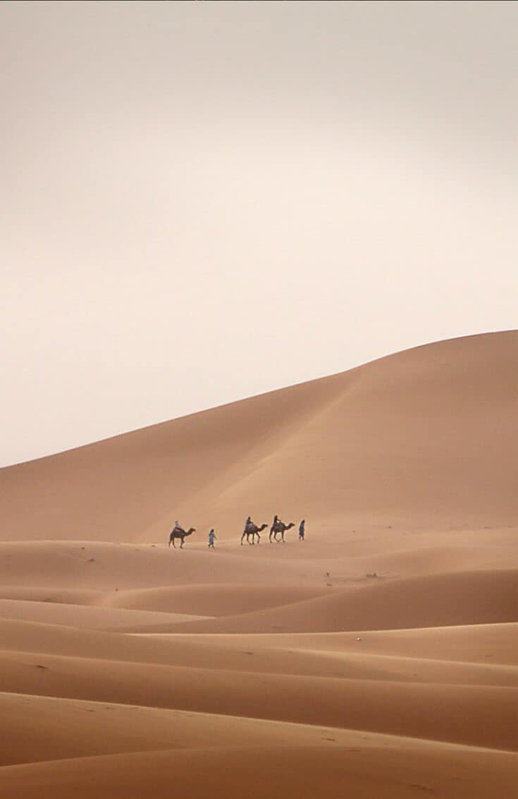
With a total area of over 3.5 million square miles, the third biggest desert in the world covers approximately 31% of the African continent. It spans 12 different North African countries, from Mauritania and Morocco in the west over to Egypt and Sudan in the east.
The Sahara is the largest hot subtropical desert in the world: Only the Arctic and Antarctica are bigger. Its low latitude location makes it extremely hot and dry, with virtually no rainfall whatsoever.
Yet still it boasts a surprisingly diverse array of flora and fauna, including around 2800 species of plants. Humans have lived here for at least 10,000 years, with some 30,000 petroglyphs remaining as evidence.
In terms of wildlife, the region is home to three species of Fox, numerous Gazelles and Antelopes, two endangered subspecies of Cheetah, African Wild Dogs, Monitor Lizards, Hyrax, North African Ostrich, Desert Crocodiles, and numerous other animals. In terms of domesticated species, Camels and Goats are by far the most common.
READ MORE: Top 5 Ecotourism Attractions in Egypt
KALAHARI DESERT (#6- Southern Africa)
Covering approximately 360,000 square miles, the world’s sixth biggest desert is in central Southern Africa. It ranges from Angola down through Botswana and Namibia to South Africa. The hunter-gatherer San people have inhabited this area for over 20,000 years.
The Kalahari is what’s known as a semi-desert, receiving around 5 to 10 inches of rain each year on average. It has vast expanses of arid land, including salt pans such as Namibi’s Etosha Pan and Botswana’s Makgadikgadi Pan (one of the largest in the world).
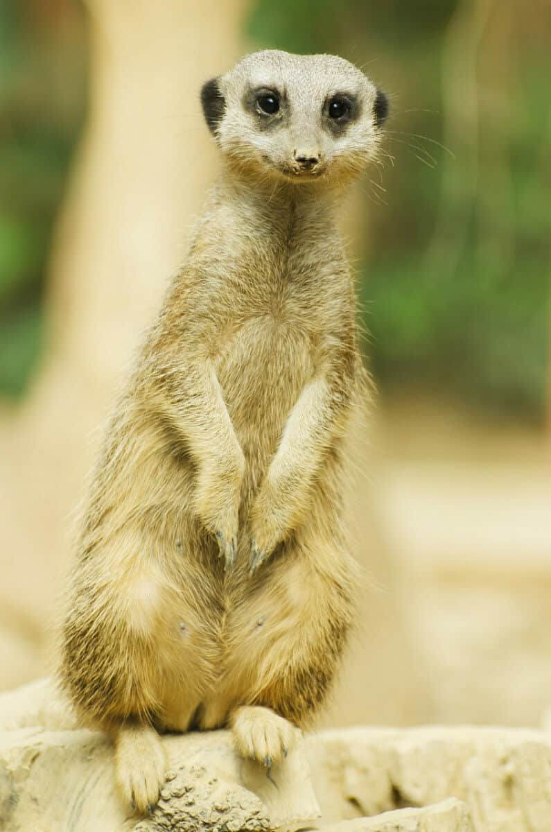
But it’s also home to Okavango River, which flows into the world-renowned delta of the same name. So, depending on where you go, you may see wildlife such as African Wild Dogs, Cheetahs, Giraffes, Leopards, Lions, Spotted Hyenas, and countless other species.
If you’re interested in taking a wildlife safari, the Kalahari has several amazing destinations that have yet to see the overcrowding that comes with mass tourism.
The most noteworthy are Kgalagadi Transfrontier Park, Central Kalahari Game Reserve (the world’s second largest wildlife park), and Tswalu Kalahari (Southern Africa’s largest private game reserve).
READ MORE: My Life Changing Experience in South Africa
NAMIB DESERT (#25- Angola/Namibia)
Encompassing 31,000 square miles, the Namib Desert is by far the smallest on this list. But if you talk to anyone who’s traveled there, they’ll probably tell you it’s the desert most worth visiting, containing some of Namibia’s most incredible ecotourism attractions.
Though sparsely populated, there are rich indigenous cultures there, such as the Himba and Herero people. There’s the Skeleton Coast, which is littered with more than 1,000 shipwrecks due to the dense fog there. There are massive Fur Seal colonies, not to mention the Lions that often prey on them.
In terms of other wildlife, the region is home to numerous weird animals that have adapted to the arid climate. These include Desert Elephants and a Darkling Beetle that can catch and drink moisture from fog using bumps and troughs on its back.
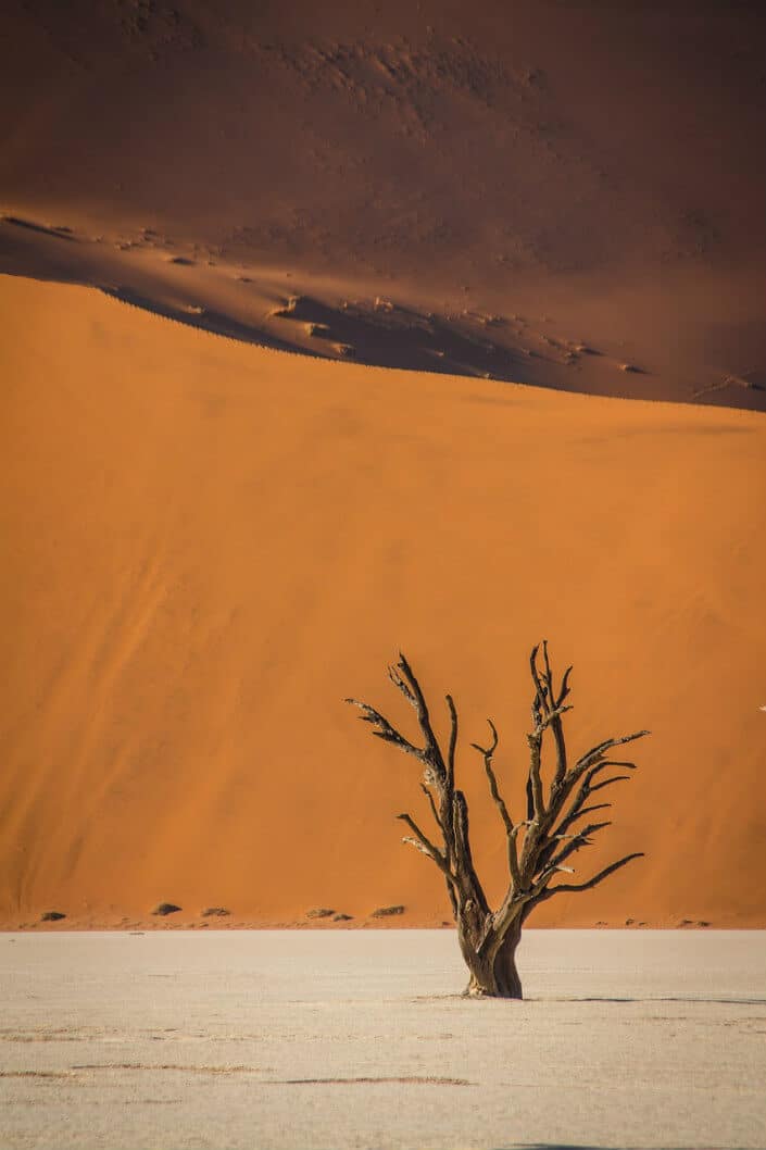
But the region’s #1 attraction is Namib-Naukluft National Park, one of the largest in the world. The park is home to iconic sites such as the striking red dunes of Sossusvlei, the skeleton trees of Deadvlei, and Sesriem Canyon (a 98-foot deep canyon that’s often overlooked by tourists).
READ MORE: 70 Weird Animals Around the World
DESERTS IN ANTARCTICA (#1)
OK, so technically “deserts in Antarctica” is a misnomer. Antarctica encompasses more than 5.5 million square miles, and every single inch of it is technically a frozen desert, making it the largest desert on earth. In fact, it is the coldest, windiest, and driest of all the continents on the planet.
It certainly doesn’t look like a desert. The entire continent is covered in a thick layer of ice for the majority of the year. It’s surrounded by water and massive icebergs the size of small skyscrapers.
But the definition of a desert is “a barren area of landscape where little precipitation occurs and consequently living conditions are hostile for plant and animal life.” And in that sense, Antarctica fits the bill perfectly.
The South Pole averages less than 4 inches of rain each year, and the interior (which can reach -112º to -128ºF during winter) is as inhospitable as you can imagine.
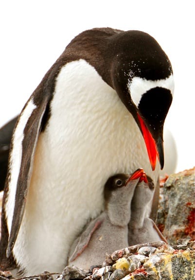
Which makes it all the more remarkable to see how much life. There are 8 different species of Penguins in Antarctica, and dozens of species of shorebirds in summer. There are also 6 species of Seals, and 15 species of Whales in the frigid waters.
READ MORE: The Haunting Beauty of Icebergs in Antarctica
DESERTS IN ASIA
ARABIAN DESERT (#4- Western Asia)
Spanning some 900,000 square miles, the world’s fourth largest desert spans the majority of the Arabian Peninsula. The desert covers virtually all of Saudi Arabia as well as parts of Iraq, Jordan, Kuwait, Oman, Qatar, the UAE, and Yemen.
The Arabian Desert is actually an extension of the Sahara, with a similar subtropical climate. In other words it’s extremely hot (over 104º F in summer, and up to 115º along the Persian Gulf) and dry, with some areas averaging less than 2 inches of rain per year.
But parts of the desert occasionally do freeze at night in higher elevations.
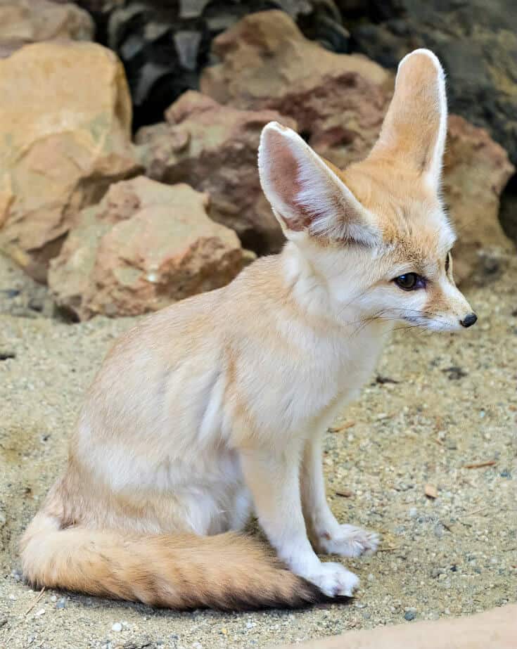
Although there are a few endemic plants, this is one of the least biodiverse deserts on this list. But there are a few wildlife species that have found a way to survive here, including the Arabian Oryx, Fennec Fox, Sand Cat, Sand Gazelle, and Spiny-tailed Lizard.
But still, make no mistake about it, the Arabian Desert offers one of the most extreme and inhospitable landscapes on the planet.
From the vast Rub’ al Khali section (“the Empty Quarter”) to the treacherous quicksand of Umm al Samim (known locally as the “Mother of Poisons” or “Mother of Worries”), this is not the type of place you want to get lost in.
READ MORE: Ecotourism in Jordan: The Ultimate Travel Guide
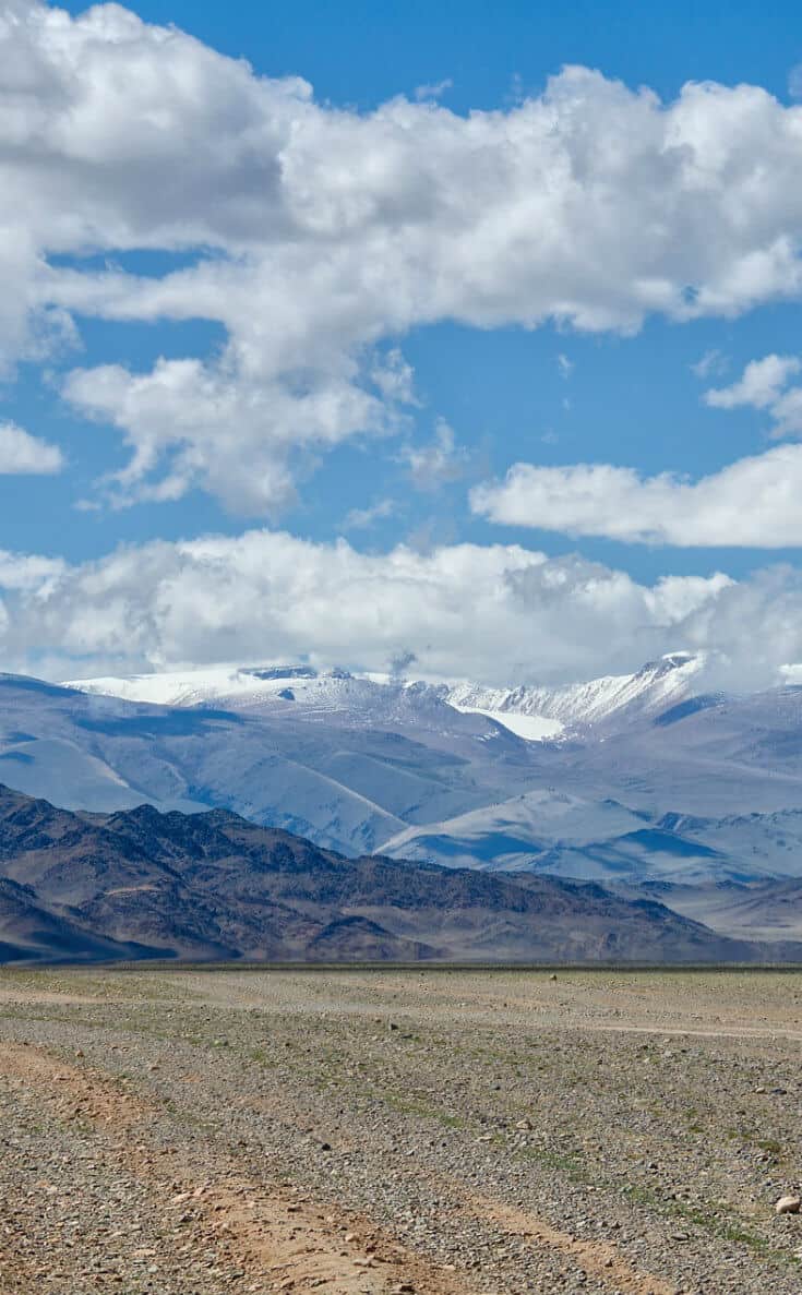
GOBI DESERT (#5- China & Mongolia)
Of all the deserts on this list, the Gobi Desert is one we’re especially eager to visit. The fifth largest desert in the world, it spans some 500,000 square miles in northern China and southern Mongolia. The Gobi is a rain shadow desert: The Tibetan Plateau blocks precipitation coming in from the Indian Ocean.
The Gobi is probably best known as the birthplace of Genghis Khan and his Mongol Empire, which grew to dominate much of Asia and Europe in the 13th and 14th centuries.
It’s also home to several important cities along the historic Silk Road trade route, which was vital to global expansion and cultural exchange for over a thousands years BCE (before the Christian era).
Descendants of the nomadic Mongols remain the dominant indigenous inhabitants of the Gobi steppes today. Many still live in traditional gers (similar to yurts), riding horses and herding cattle as they have for centuries.
After being repressed for 70+ years, ancient practices such as using Golden Eagles to hunt are making a comeback.
Relatively warm in summer, but often very cold in winter, the Gobi is also home to a diverse array of animal life. These include Bactrian Camels, Black-tailed Gazelles, wild Przewalski’s Horses, and the occasional Brown Bear, Snow Leopard, or Wolf.
READ MORE: Experiencing Traditional Mongolian Culture
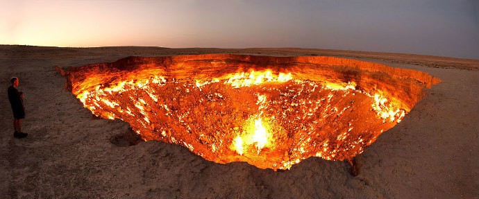
KARAKUM DESERT (#13- Turkmenistan)
Not to be confused with Kazakhstan’s much smaller Aral Karakum Desert, this 135,000-square mile desert in Central Asia covers around 70% of Turkmenistan. Its name means “Black Sand,” a reference to the dark soil that lies just beneath the sandy surface.
The desert has several noteworthy features. The desert is crossed by the world’s second largest irrigation canal, the 854-mile Karakum Canal, which transports water from the Amu Darya river in the north to cities in the south, such as Mary and Tejen.
As a result, those areas are oases, known for growing cotton and melons.
But the region’s primary tourist attraction is the Darvaza gas crater, more commonly known as the “Door To Hell” or “Gates of Hell.” The fiery inferno started in 1971, when Turkmenistan was still part of the Soviet Union. Geologists were in the Karakum searching for oil fields, and set up their equipment to begin drilling.
Unfortunately they were on top of a pocket of natural gas, which collapsed and created several open craters. The largest of these measured 230 feet across and 65 feet deep.
The methane leaking from this pit of despair started killing animals in the area, so the scientists lit it on fire. This middle-of-the-desert bonfire has been aflame ever since!
KYZYLKUM DESERT (#16- Central Asia)
The world’s 16th largest desert encompasses approximately 115,000 square miles in Kazakhstan, Uzbekistan, and Turkmenistan. Its name translates to “Red Sand.”
The Kyzylkum Desert is most famous in the paleontology arena, as there have been numerous important fossils discovered in its exposed rock formations.
The Bissekty Formation of Uzbekistan, which dates back to the Late Cretaceous epoch, is probably the most famous. It produced fossils from numerous early bird species as well as various armored, duck-billed, and horned dinosaurs.
In terms of tourist attractions, the desert is home to several nature reserves in Turkmenistan’s Bukhara Region.
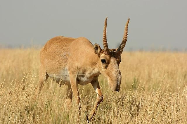
The largest, Kyzylkum Nature Reserve (39,000 square miles), is home to animals such as the Bukhara Deer, Desert Monitor lizard, Golden Eagle, and Saiga Antelope.
The 19,860-square-mile Djeyran Nature Reserve breeds rare animals such as the Houbara Bustard, Persian Gazelle, and the endangered Przewalksi’s Horse.
READ MORE: Facts about Mongolian Horses (Przewalski’s Horse)
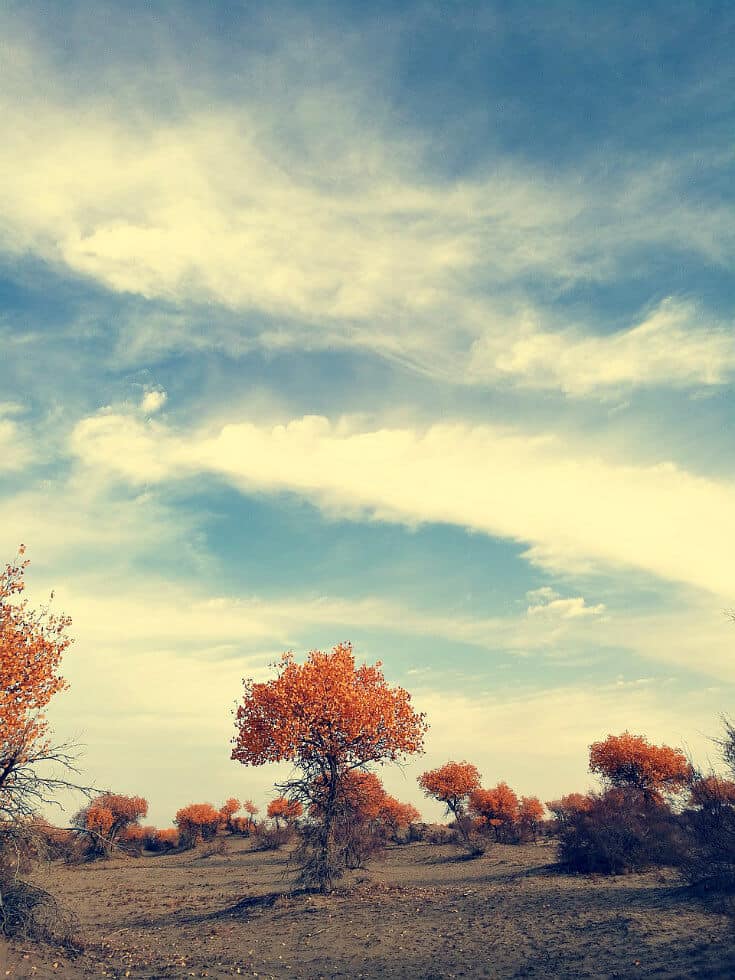
TAKLAMAKAN DESERT (#17- China)
Located in northwestern China, the 17th biggest desert in the world lies west of the Gobi Desert. Spanning 130,000 square miles, it’s surrounded on the other three sides by the Kunlun, Pamir, and Tian Shan Mountains.
The name Taklamakan is widely interpreted to come from the Persian words for “place of no return,” while others suggest it means “place of ruins.”
Both would be accurate: The heart of the desert sees very little rainfall, making it hazardous to cross. And archaeologists have unearthed treasures there, including 4,000-year-old mummies, buried in ruins beneath the sand.
Interestingly, the relics reflect Indo-European, Mediterranean, and Indian influences. Which makes sense because the ancient Silk Road passed through the northern and southern sections of the desert. Today, there are two cross-desert highways constructed b y the People’s Republic of China.
READ MORE: Top 7 Things to Do in China for Nature Lovers
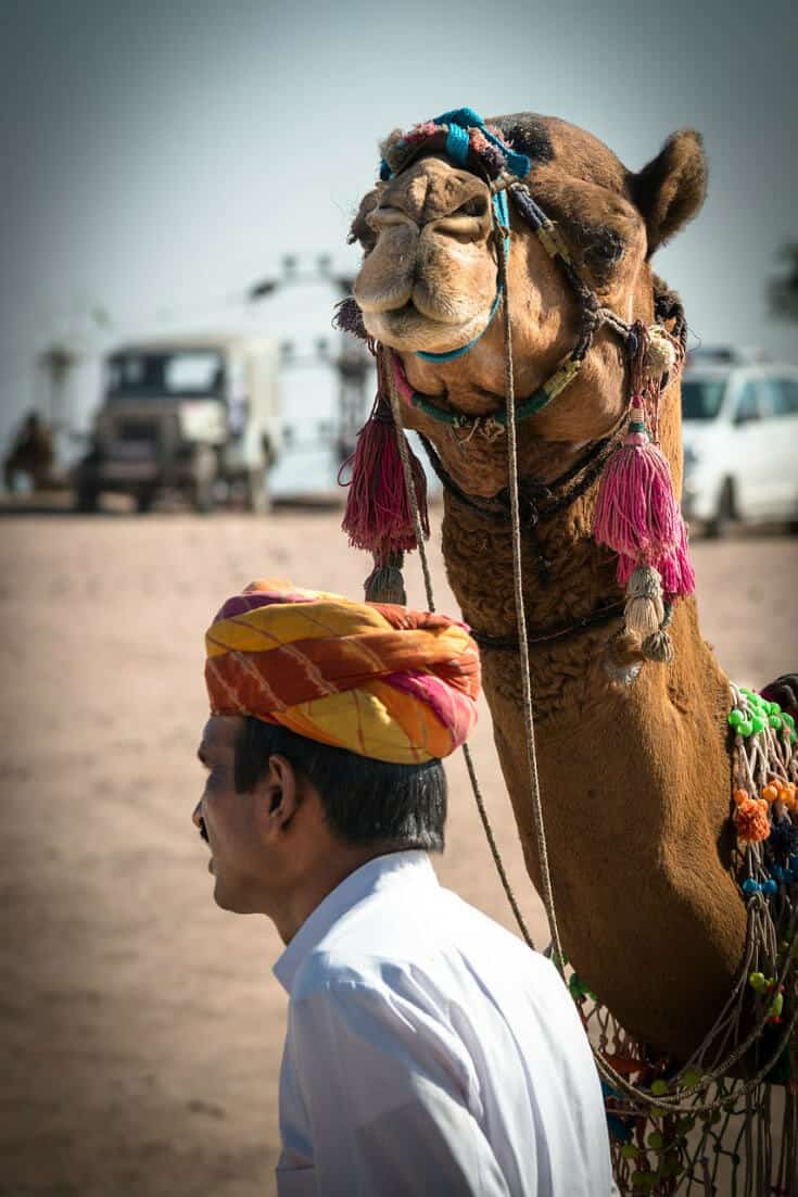
THAR DESERT (#18- India & Pakistan)
Measuring 77,000 square miles, the Thar Desert (a.k.a. Great Indian Desert) forms a natural boundary line dividing two countries that were formerly one.
About 85% of it lies in northwest India, with the other 15% in Pakistan. With an average of 83 people per square mile, it’s the most heavily populated desert in the world.
With around 40% of Rajasthan’s total population living in this subtropical desert, agriculture is both a challenge and a priority. The focus is on kharif (or monsoon) crops– including beans, corn, pearl millet, and wheat– which are seeded in early summer and harvested in September and October.
The desert is home numerous protected areas, including India’s Desert National Park and Sundha Mata Conservation Reserve and Pakistan’s Nara Desert Wildlife Sanctuary.
There’s a surprising array of wildlife to be found there, including the Bengal Fox, Blackbuck, Caracal, Indian Gazelle, Wolves, and 141 different bird species.
The region’s ecotourism industry is growing as result of this biodiversity, with desert Camel safaris becoming increasingly popular. Another major attraction is the annual Pushkar Camel Fair, which is widely considered among the world’s best festivals.
READ MORE: The 20 Best Festivals in the World (For Your Bucket List)
DESERTS IN AUSTRALIA
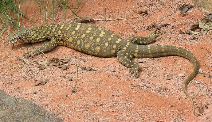
GREAT VICTORIA DESERT (#7)
Named after the British monarch, Great Victoria is the largest desert in Australia, spanning some 220,000 square miles in the southwestern section of the continent. Unlike some of the deserts on this list, it gets 15 to 20 thunderstorms each year, providing around 8 to 10 inches of rain annually.
The entire Great Victoria Desert has been delineated as a World Wildlife Fund ecoregion.
As a result, several parts are protected, including the Mamungari Conservation Park (one of Australia’s 14 World Biosphere Reserves), the Great Victoria Nature Reserve, and portions of the Anangu Pitjantjatjara Yankunytjatjara Aboriginal area.
Due to the harsh climate, there’s not a ton of wildlife. There are a few vulnerable/endangered species, such as the Great Desert Skink and the Sandhill Dunnart (a marsupial mouse).
You may also see predators such as Dingo and two species of Monitor Lizards. But most animals, including the Southern Marsupial Mole and Water-holding Frog– bury themselves in the sand to stay cool.
The most interesting part of the Great Victoria for visitors is the many indigenous Australians who call the area home. These include the Kogara, Mirning, and Pitjantjatjara (who call themselves Anangu) peoples.
Some of these people have been to key to the battle over indigenous land rights in Australia, including those surround Uluru (Ayers Rock) and Kata Tjuta (the Olgas).
READ MORE: Top 5 Australia Ecotourism Attractions
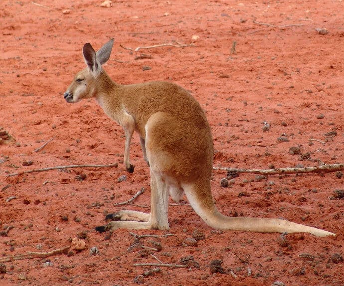
GREAT SANDY DESERT (#12)
The 12th largest desert in the world, the Great Sandy Desert encompasses 110,000 square miles in northwestern Australia, straddling the Kimberley and Pilbara regions.
The desert gets more rain than those in other parts of the world, averaging around 14 inches each year. But its coastal and far northern regions tend to have serious water issues caused by drought, which often ends in monsoon clouds or tropical cyclones.
As a result, the Great Sandy Desert is sparsely populated, and several people have died after their vehicles broke down in remote areas.
There are two aboriginal communities, with the Martu inhabiting the west and the Pintupi in the east. Their indigenous artwork is a huge industry, and one of the main reasons people visit the region.
Most of the area’s ecotourism industry is concentrated in the Kimberley region to the north. But the desert does serve as home to wildlife such as Bearded Dragons, feral Camels, Dingos, Goannas, Red Kangaroos, and the Rufous Hare-Wallaby.
READ MORE: Top 10 Australian National Parks
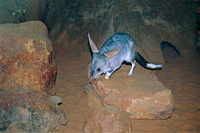
TANAMI DESERT (#19)
The continent’s third biggest desert at 71,236 square miles, the Tanami spans from the Northern Territory into Western Australia. It’s widely considered northern Australia’s last truly wild frontier because it wasn’t explored by European until the mid 20th century.
The desert’s name comes from the aboriginal Walpiri name for the region, Chanamee. This roughly translates to “never die,” a reference to holes in the desert that never ran out of water.
The Tanami receives considerably more rainfall than other deserts, with an average of nearly 16 inches. During the wet season, the Tanami Track often becomes impassable due flooding.
As a result, the Tanami Desert actually includes a few wetland areas, including Lake Surprise (Northern Territory) and Lake Gregory (Western Australia), the latter of which retains permanent surface water rather than turning into salt flats during the dry season.
The Tanami is considered among Australia’s most important areas for conservation, as it provides refuge for numerous rare and endangered species. Wildlife you can find there include the Bilby, Mulgara (similar to Tasmanian Devil), Rufous Hare-Wallaby, and Grey Falcon.
Many species are increasingly threatened by feral invaders, overgrazing, and habitat degradation of the Outback.
READ MORE: Tasmanian Devil Conservation
SIMPSON DESERT (#20)
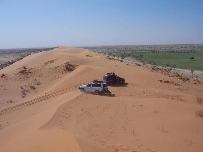
At 68,147 square miles, this is the fourth biggest desert in Australia. But it ranks as the largest sand dune desert in the world, with one dune (known as Nappanerica) that towers at over 130 feet in height.
Stretching from the Northern Territory into Queensland, the Simpson was first seen by European eyes (those of British explorer Charles Sturt) in 1844. There are no maintained roads across the desert, but it has historically attracted hardy adventurers (including explorer Sebastian Copeland, who hiked it in 2016).
It’s also increasingly popular among tourists, who are drawn by attractions such as Approdinna Attora Knoll and the ruins at Dalhousie Springs. The World Wildlife Fund ecoregion also boasts seasonal wetlands that are home to an array of wildlife, especially birds.
All of which are fine to visit in the winter months (June to September), when the desert’s brutal temperatures cool down a bit.
But during the southern hemisphere’s summer (December to February), temps can rise over 120º F, with intense sandstorms. So Australia’s Department of Environment & Natural resources actually closes the desert then for safety reasons.
READ MORE: Interview with Sebastian Copeland
DESERTS IN EUROPE
THE ARCTIC (#2- Europe & North America)
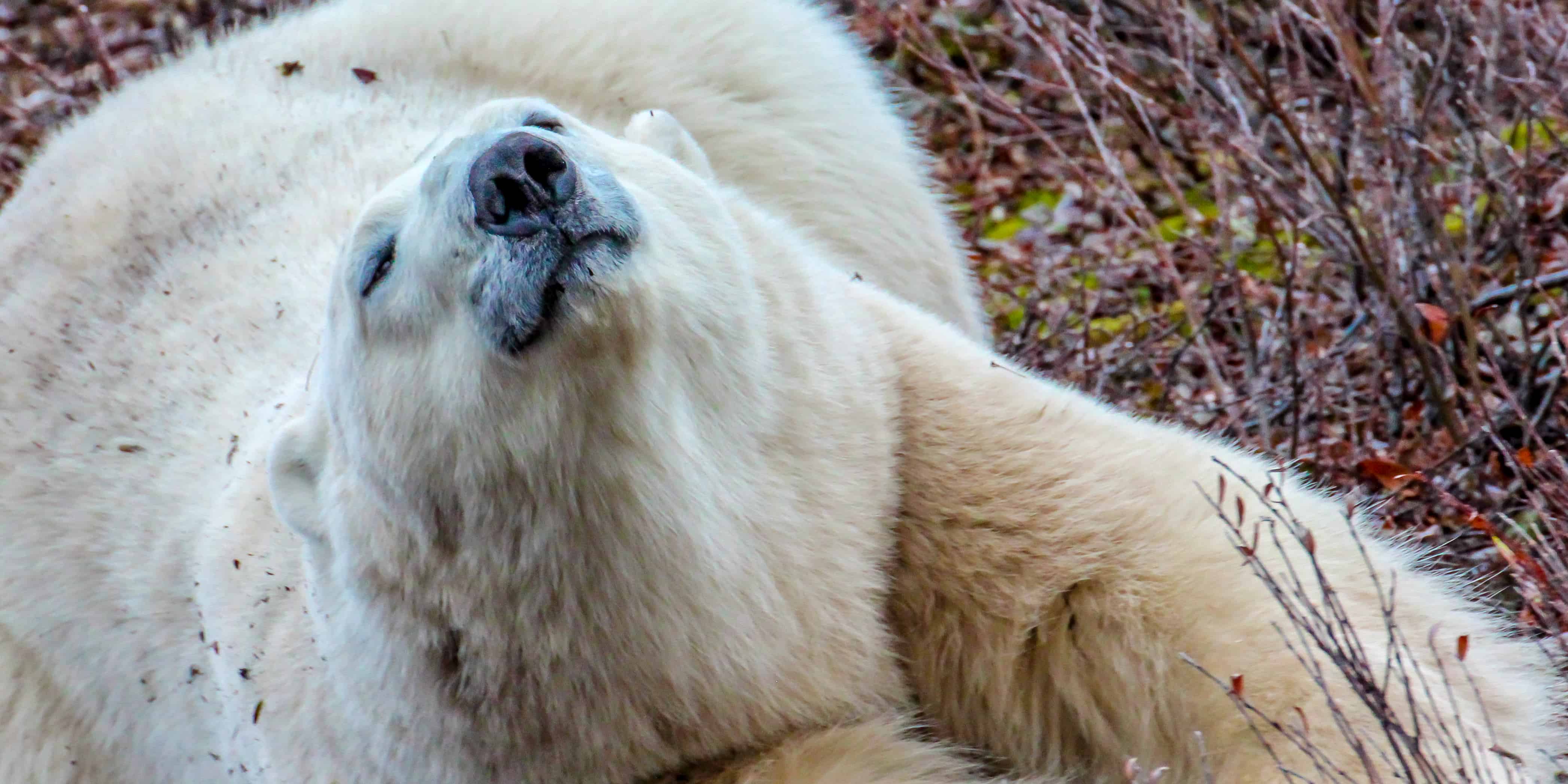
Second only to Antarctica in terms of size, the Arctic spans 5.4 million square miles that encompasses parts of Russia and Scandinavia, most of Greenland, and northern Alaska and Canada. The region is rugged, remote, frigid, and goes from mostly dark all day in winter to mostly light all day in summer.
The Arctic Circle is one of the planet’s last truly wild places, home to more than 500,000 indigenous peoples (whose ancestors settled there tens of thousands of years ago) and an impressive array of wildlife.
Unfortunately, the effects of climate change, including shrinking sea ice and rapidly warming oceans, are dramatically impacting their ability to survive.
For travelers, the Arctic offers plenty of opportunities for adventure activities, including kayaking, ATV excursions, cross-country skiing, hiking, catch and release fishing, and more. But wildlife is where the region really excels, with Arctic animals such as Polar Bears, Moose, Caribou, and more.
As many as 2,000 Beluga Whales come to Canada’s Cunningham Inlet each year to nurse their young in the river’s relatively warm waters.
Kayaking provides opportunities for close-up encounters with these beautiful creatures as well as Whales and Narwhals.
The region’s hiking trails may lead to sightings of Muskox, Arctic Foxes, Arctic Hares, Snowy Owls, and Ptarmigan.
READ MORE: Polar Bear Fight (with Video)
DESERTS IN NORTH AMERICA
CHIHUAHUAN DESERT (#11- Mexico & United States)
The eleventh largest desert in the world, the 175,000-square mile Chihuahuan Desert straddles a huge swath of the US-Mexico border. Its range covers much of West Texas, southern New Mexico, the southeast corner of Arizona, and a good chunk of the Mexican Plateau.
The second largest desert in North America, the Chihuahuan is also one of the world’s most densely populated. The desert includes sizable cities such as Chihuahua, Ciudad Juárez, and Saltillo on the Mexican, and Albuquerque, El Paso, and Roswell on the US side.
It’s considered a rain shadow desert because the Sierra Madre Occidental range blocks precipitation from the Pacific, while the Sierra Madre Oriental range blocks it from the Gulf of Mexico.
As a result, the region averages just nine inches of rain each year, mostly in the summer months. But because its elevations range from around 2,000 to 5,500 feet, it remains mild in summer and cold in winter.
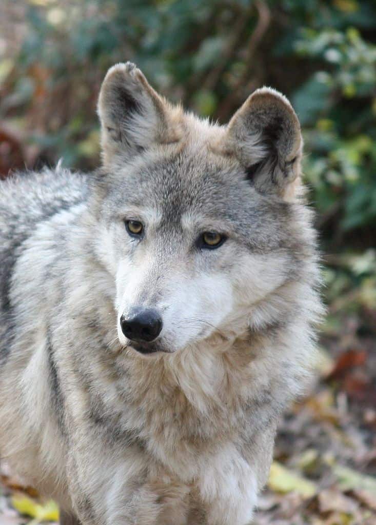
According to WWF, the Chihuahuan Desert ranks among the world’s most biologically diverse. Though many of the endemic species are threatened by overgrazing, the region is home to Prairie Dog, Kit Fox, Mule Deer, Pronghorn, Blacktailed Jackrabbits, and the endangered Mexican Wolf.
COLORADO PLATEAU (#14- United States)
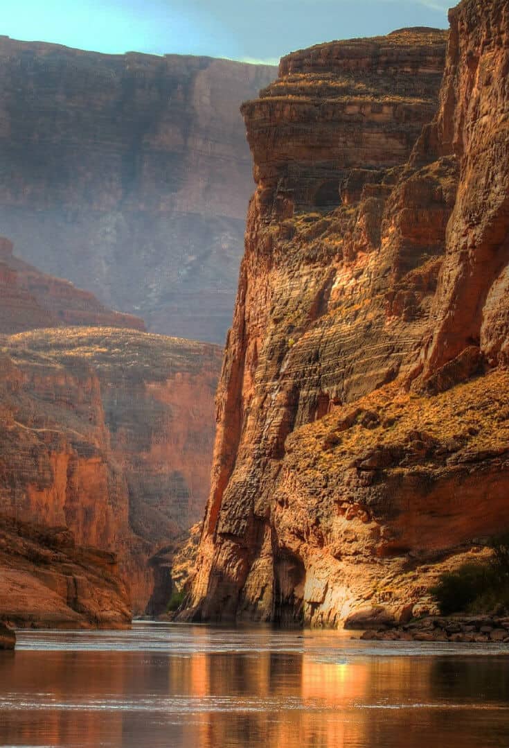
Centered in the Four Corners region of the Southwestern United States, the Colorado Plateau covers around 130,000 square miles. Made up of high desert with scattered forests, it covers northern Arizona, western Colorado, northwestern New Mexico, and southern and eastern Utah.
Outside of Washington, DC, this region boasts more National Park Service units than any other part of the US. These include nine national parks: Grand Canyon, Zion, Bryce Canyon, Capitol Reef, Canyonlands, Arches, Mesa Verde, and Petrified Forest.
It also includes 18 National Monuments, such as Bears Ears, Natural Bridges, and Chaco Culture National Historical Park.
Most of the Plateau’s landscape will b familiar to anyone who’s ever visited (or seen pictures of) the Grand Canyon. Widely known as “Red Rock Country,” the region’s brightly colorful geology has been sculpted by dryness and erosion into a dazzling array of domes, reefs, natural bridges, and slot canyons.
Needless to say, there’s plenty of things for visitors to do. Popular activities range from hiking and camping in the various parks and rafting the Colorado River to exploring the incredible pueblos of the ancient Anasazi culture.
READ MORE: Ancient Archaeological Sites (For Your Bucket List)
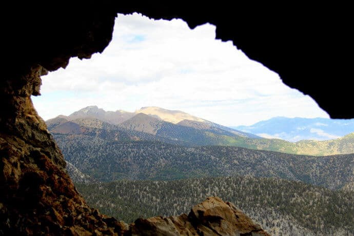
GREAT BASIN DESERT (#10- United States)
The largest desert in the United States at around 190,000 square miles, the Great Basin Desert is located between the Sierra Nevada and Wasatch mountain ranges.
It covers much of Nevada, but also stretches into southern Idaho and Oregon, a good portion of western Utah, and eastern California.
Part of the Great Basin, the cold winter desert’s topography and ecology is fascinating. There are more than 30 peaks with summits of over 9,800 feet; wide high-elevation valleys; salty dry lakes (Lahontan and Bonneville); and forests filled with Pine and Juniper.
As a result of these diverse ecosystems, much of the region is protected land. Its primary attractions include Great Basin National Park, the Humboldt-Toiyabe National Forest, seven wilderness areas (overseen by the Bureau of Land Management), and four National Wildlife Refuges.
These parks and refuges help to protect a wide array of vital wildlife habitats, many of which are small and isolated. There are an estimated 600 species living in the area, around 63 of which are considered important conservation priorities.
These include the Greater Sage-Grouse, Kit Fox, Ord’s Kangaroo Rat, and the Desert Horned Lizard.
READ MORE: Complete List of US National Parks by State
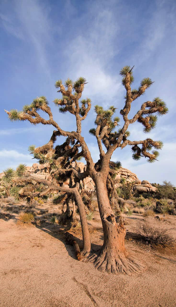
MOJAVE DESERT (#24- United States)
Squeaking into our list of the world’s largest deserts at #24, the Mojave’s fame belies its relatively small size (approximately 48,000 square miles). That’s because, while the interior is sparsely populated, the perimeter touches major cities such as Las Vegas, Nevada and San Bernadino, California.
Bordered by the Great Basin Desert to the north and the Sonoran Desert to the south and east, the Mojave is often referred to as the “high desert.” It does have elevations of over 2,000 feet, but it is also home to Death Valley, which has the lowest elevation in North America (280 feet below sea level).
Even if you discount the visitors drawn to Las Vegas, the Mojave still ranks among the most popular tourism hotspots in the US.
The desert is home to Death Valley National Park, Joshua Tree National Park, Lake Mead National Recreation Area, Mojave National Preserve, Red Rock Canyon National Conservation Area, and numerous other parks and reserves.
It’s also home to some incredible wildlife, including Bobcats, Cougars, Desert Bighorn Sheep, Desert Tortoises, Gila Monsters, Jackrabbits, Mule Deer, Pronghorn and dozens of other species.
It’s also home to venomous snakes such as the Mojave Green Rattlesnake, Sidewinder Rattler, and Western diamondback rattlesnake. So if you go hiking, make sure to watch your step!
READ MORE: 10 Best US National Parks (For Your Bucket List)
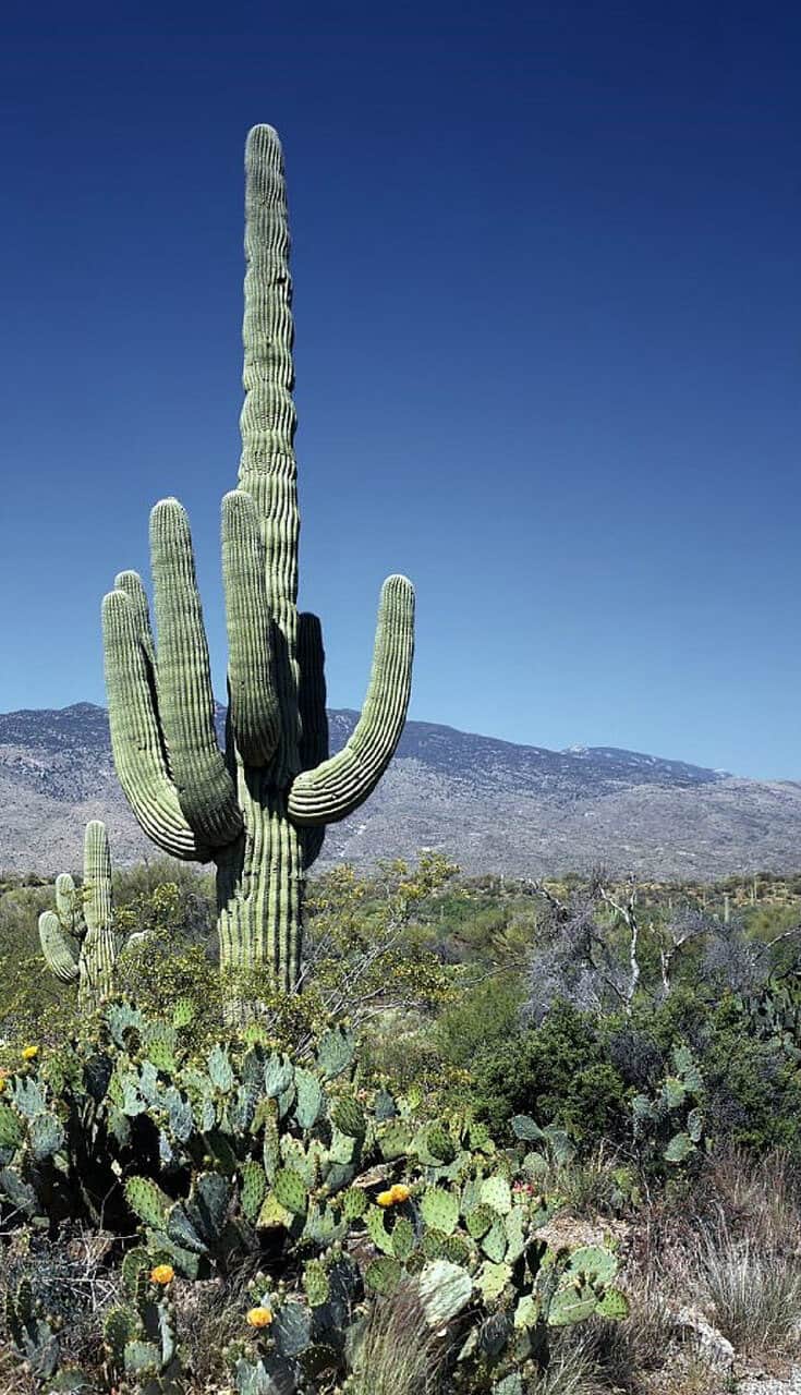
SONORAN DESERT (#15- Mexico & United States)
Located west of the Chihuahuan Desert, the world’s 15th largest desert similarly straddles the US-Mexico border. It covers some 120,000 square miles, from Southern California and Arizona south to the Mexican stats of Baja California and Sonora.
The area has been divided up into seven different sub-regions. These include the Colorado Desert, Gran Desert de Altar, Lechuguilla Desert, Yuma Desert, and several other small deserts.
It also features the Colorado River Delta, an ecological hotspot where the river feeds into the Gulf of California (a.k.a. Sea of Cortez).
Despite the harsh climate, the desert is home to a remarkable diversity of both flora and fauna. Thanks to two seasons of rainfall, there are some 2,000 different plant species– more than any other desert in the world.
These include the famous Saguaro Cactus, other cacti with colorful names (Beavertail, Hedgehog, Organ Pipe), and gorgeous Sonoran wildflowers after the rains.
In terms of wildlife, the desert is home to over 350 bird species, 100 reptile species, 60 mammal species, 20 amphibian species, and over 1000 native species of bees.
But its most famous animal resident is arguably the Jaguar: The desert southeast of Tucson is the only place they’re found within the United States.
DESERTS IN SOUTH AMERICA
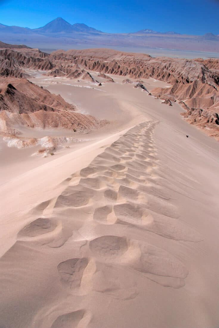
ATACAMA DESERT (#23- Chile & Peru)
Though it only ranks #23 in the world is terms of size, the Atacama Desert holds the title for the driest non-polar place on the planet.
Covering 54,000 square miles in northern Chile and southern Peru, the area receives less than 0.01cm of rainfall each year. In fact, some spots in the desert haven’t seen any rain whatsoever for over 400 years now!
Situated between two massive mountain chains (the Andes and the Chilean Coast Range), this area has an average altitude of 7,900 feet.
This bizarre mixture of extreme heat and altitude makes this a challenging region to hike through. Yet many people come here throughout the year to trudge their way across this incredibly sparse, yet beautiful landscape.
One of the Atacama’s most otherworldly attraction is the Valle de la Luna (Valley of the Moon). With jagged, unpredictable rock formations and volcanoes, the entire area has been shaped by harsh, dry winds.
It sort of looks like the surface of the moon, or Mars. In fact, this alien landscape was where the Mars Rover was tested, due to the ground’s sharp, undulating surface.
As a result of the harsh climate, both human and animal presence is several limited. But you will find Humboldt Penguins on the desert cliffs along the coast, Andean Flamingos eating algae on the salt flats, and Guanacos, Vicuñas, and Grey Foxes in the less arid areas.
READ MORE: Trekking the Atacama Desert (The Driest Place on Earth)
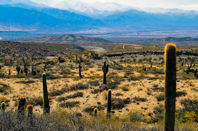
PATAGONIAN DESERT (#8- Argentina & Chile)
When most people think of Patagonia, the first thing that comes to mind is Torres del Paine National Park. The park encompasses 242,242 hectares and averages around 150,000 annual visitors, making it one of the largest and most visited parks in Chile.
The park’s popularity is well-deserved: In addition to the iconic Paine Massif, part of the Patagonian ice field, and some truly stunning lakes, it’s home to animals ranging from Guanacos (a.k.a. Patagonian Llamas) and Pumas to Andean Condors and Caracaras.
But the Patagonian Desert (the world’s eighth largest) is much more expansive, covering more than 200,000 square miles. Bounded by the Andes Mountains to the west and the Atlantic Ocean to the east, the majority of the desert lies in Argentina.
It’s a cold winter desert, with temperatures rarely exceeding 53ºF and averaging around 37ºF.
The region has been inhabited by indigenous hunter-gatherers since Pre-Hispanic times, but became plagued by conflict in the 19th century due to migration.
It’s sparsely populated, but the less dry potions of the steppe saw a sheep farming boom in the early 20th century. Raising livestock remains the most common occupation in the region today.
READ MORE: Patagonia Flowers: The Flora of Torres del Paine
DESERTS YOU SHOULDN’T VISIT (YET)
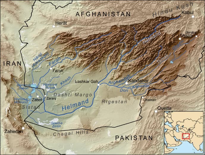
DASHT-E MARGO DESERT (#20- Afghanistan)
To be absolutely clear, we do not recommend traveling to the Dasht-e Margo Desert, which is located in southern Afghanistan near the border with Iran. We are including it on this list only because, at 150,000 square miles, it’s the 20th largest desert in the world.
Unfortunately, its Persian name translates to “Desert of Death.” And by all accounts, the region’s nickname is well-earned.
The Guardian described it as a place “where opium farmers, smugglers and ruthless armed tribesmen scratch out a living hundreds of miles from electricity, roads or sanitation.”
It’s most famous as the region in which seven suspected al-Qaeda militants were killed in 2003 during the hunt for Osama bin Laden. Even now, seven years after bin Laden’s death, the region remains a hotbed of Opium poppy production and a stronghold for the Afghan Taliban.
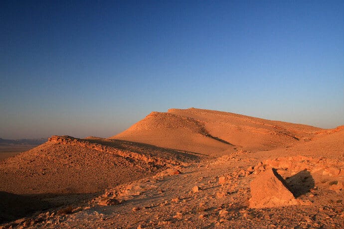
SYRIAN DESERT (#9- Western Asia)
If you follow the news, you already know why the world’s ninth largest desert (which also includes parts of Iraq, Jordan, and Saudi Arabia) is on our “DO NOT VISIT” list. Not to mention that of the US, UK, and many other governments.
To quote from the Wikitravel page on Syria, “Travel to Syria is STRONGLY discouraged due to an ongoing civil war. Since 2011, nearly 525,000 people have been killed. Government security forces and rebel groups are engaged in open warfare in many rural and urban areas. It is EXTREMELY DANGEROUS for foreigners in Syria.”
It’s a shame, as the 200,000 square mile desert is home to some of the world’s most stunning archaeological sites.
The city of Palmyra was a vital center of trade during Roman times, when it linked the Silk Road route from the Far East to Mediterranean. Dura-Europos, on the Euphrates River, was an important link between the Mediterranean and Mesopotamia.
If/when the situation in Syria becomes peaceful again, tourism to these ancient landmarks could prove vital to the country’s resurgence.
READ MORE: Ancient Archaeological Cites (For Your Bucket List)
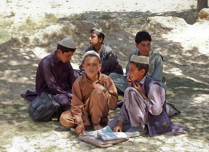
REGISTAN DESERT (#21- Afghanistan)
The Registan Desert is located just below the Dasht-e Margo Desert in southern Afghanistan, on the border with Iraq and Pakistan. And the 56,400 square mile subtropical desert is on our “DO NOT VISIT” list for the exact same reasons.
It’s remote and rugged terrain in a region where drug smugglers and armed militants are too common for comfort.
Even the Baluchi and Pashtun nomads who used to call the desert home have been displaced by severe drought, as the desert gradually spread into the agricultural areas that surround it. Sand dunes up to 50 feet high covered roads and entire villages.
The United Nations Environment Programme set up temporary camps for some 100,000 displaced locals in the Kandahar Province. They’re currently working to find a way to return the nomads to their traditional livelihood, which was raising livestock. –Bret Love
FAQs & DESERT FACTS
How many deserts are there in the world?
There are 33 major deserts from subtropical and cool coastal to cold winter deserts.
What is the largest desert in the world?
Antarctica is the largest desert in the world.
What is the largest subtropical desert in the world?
The Sahara Desert.
What is the largest hot desert in the world?
The Sahara Desert.
What is the hottest desert?
The hottest desert varies year-to-year between the Sahara, the Gobi, the Sonoran and the Dasht-e Lut.
What is the largest cold desert in the world?
At more than 5.5 million square miles, Antarctica it the largest cold desert on earth.
Which desert has the largest population?
Measuring 77,000 square miles, the Thar Desert (a.k.a. Great Indian Desert) covers part of India and Pakistan. With an average of 83 people per square mile, it’s the most heavily populated desert in the world.
